Object Number 58-34-20/61843
Display Title 
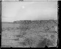
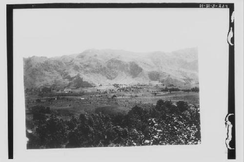
Valley from Lands near Aqua Escondida
Descriptions
Subject
  • Landscape
  • Mountain
Department Photographic
Geography/Provenience/Site Name
Central America / Guatemala / Solola / <County> / <City> / Agua Escondida

Important Note about Historical Language

Collections records may contain language, reflecting past collecting practices and methods of analysis, that is no longer acceptable. The Peabody Museum is committed to addressing the problem of offensive and discriminatory language present in its database. Our museum staff are continually updating these records, adding to and improving content. We welcome your feedback and any questions or concerns you may want to share. Please email us with your comments.

PrimaryMedia Object Number Title Classification Geography/Provenience SHARE
"Bad Lands" - Near Coal Creek
2004.24.6456 "Bad Lands" - Near Coal Creek
New Mexico
Heavy socketed lands point (chonta palm)
53-29-30/7422 Heavy socketed lands point (chonta palm)
Lance
Raw Material
South America
Image Not Available for Rainfall regimes of W. Pakistan and its neighbouring lands. Map 3.
2005.2.303 Rainfall regimes of W. Pakistan and its neighbouring lands. Map 3.
Pakistan
Image Not Available for Physical features of W. Pakistan and its neighbouring lands.
2005.2.302 Physical features of W. Pakistan and its neighbouring lands.
Pakistan
Image Not Available for 9 sherds - Escondida Polychrome, Tonto Variant
968-13-20/23343 9 sherds - Escondida Polychrome, Tonto Variant
Casas Grandes
Image Not Available for 3 sherds - Escondida Polychrome, Tonto Variant
968-13-20/23344 3 sherds - Escondida Polychrome, Tonto Variant
Casas Grandes
Image Not Available for 6 sherds - Escondida Polychrome, Gila Variant
968-13-20/23342 6 sherds - Escondida Polychrome, Gila Variant
Casas Grandes
Image Not Available for 5 sherds - Escondida Polychrome, Gila Variant
968-13-20/23341 5 sherds - Escondida Polychrome, Gila Variant
Casas Grandes
Image Not Available for Photocopy of Map of Sepik District, Compiled by the Department of Lands and Mines, Rabaul, October 1935
65-41-70/57 Photocopy of Map of Sepik District, Compiled by the Department of Lands and Mines, Rabaul, October 1935
New Guinea
Image Not Available for "Catalogue of Keam's Canon Collection of Relics of the Ancient Builders of the Southwestern Table Lands"
43-39-00/1.2 "Catalogue of Keam's Canon Collection of Relics of the Ancient Builders of the Southwestern Table Lands"
Arizona
"Catalogue of Keam's Canon Collection of Relics of the Ancient Builders of the Southwestern Table Lands", title page.
43-39-00/1.2.1 "Catalogue of Keam's Canon Collection of Relics of the Ancient Builders of the Southwestern Table Lands", title page.
Arizona
"Catalogue of Keam's Canon Collection of Relics of the Ancient Builders of the Southwestern Table Lands", p. 1
43-39-00/1.2.2 "Catalogue of Keam's Canon Collection of Relics of the Ancient Builders of the Southwestern Table Lands", p. 1
Arizona