Skip to main content
Object Number
58-34-20/58425
Display Title
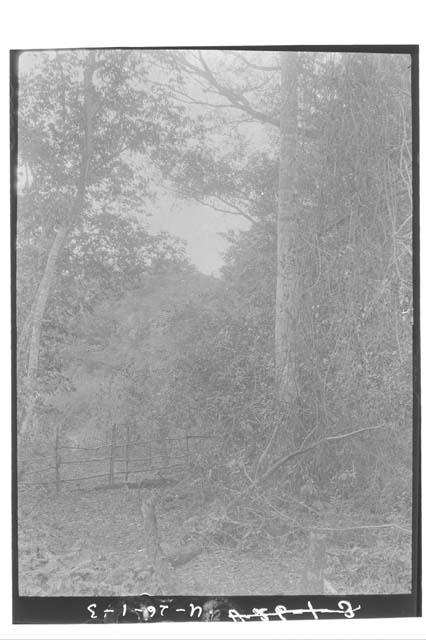
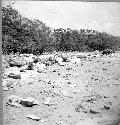
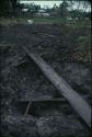
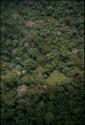
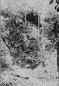
Path to Aguada and Aguada Fence
Descriptions
Subject
- Path
- Landscape
Department
Photographic
Culture
- Maya
- Classic period
Geography/Provenience/Site Name
Central America
/
Guatemala
/
Peten
/
<County>
/
<City>
/
Uaxactun
Important Note about Historical Language
Collections records may contain language, reflecting past collecting practices and methods of analysis, that is no longer acceptable. The Peabody Museum is committed to addressing the problem of offensive and discriminatory language present in its database. Our museum staff are continually updating these records, adding to and improving content. We welcome your feedback and any questions or concerns you may want to share. Please email us with your comments.
| PrimaryMedia | Object Number | Title | Classification | Geography/Provenience | SHARE |
|---|---|---|---|---|---|
| 58-34-20/58425.2 | Path to aguada and aguada fence |
Uaxactun
| ||
| 58-34-20/58425.1 | Path to aguada and aguada fence |
Uaxactun
| ||
| 58-34-20/67087 | Calzada crossing a bajo or aguada |
Punta Molas
| ||
| 58-34-20/67088 | Calzada crossing a bajo or aguada |
Punta Molas
| ||
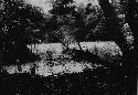
| 2004.15.19.444 | Uaxactun, principal aguada |
Uaxactun
| ||
| 2004.15.19.410 | Square aguada north of Lake Yaxha |
Peten
| ||
| 2004.15.19.45 | Aguada (seasonal waterhole) nearly dry |
Peten
| ||
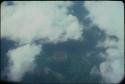
| 2004.15.19.120 | El Zapote, aguada and campsite from air |
El Zapote
| ||

| 58-34-20/44416.1 | Aguada Carolina |
Campeche
| ||
| 58-34-20/70131 | Sink Hole; South West of Main Aguada |
Uaxactun
| ||
| 58-34-20/65753 | View of Aguada |
Bambonal
| ||
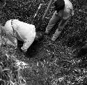
| 2004.15.1.669.4 | Digging for water by aguada at Naranjo |
Naranjo
|