Image Not Available for Pilot Chart of the North Pacific Ocean
Pilot Chart of the North Pacific Ocean
Image Not Available for Pilot Chart of the North Pacific Ocean
Object Number 2005.2.156
Display Title Pilot Chart of the North Pacific Ocean
Descriptions
Object Description 
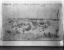
Pilot Chart of the North Pacific Ocean (this chart should not be used for navigational purposes). N.P.- October 1962. Note: On the reverse side will be found the article "Dangerous Sea Life." Closed July 25 and printed August 6, 1962. No. 1401. Founded upon the researches made in the early part of the nineteenth century by Matthew Fontaine Maury, while serving as a lieutenant in the United States Navy. Prepared from the data furnished by the Hydrographic Office, Navy Department, and by the Weather Bureau, Department of Commerce, and published by the Hydrographic Office under the authority of the Secretary of the Navy, Washington, D.C. (Legislative Act, June 17, 1910.)
Inventory Description Map, pilot chart
Date 1962
Artist Secretary of the Navy
Geography/Provenience/Site Name
Oceania
Additional Geographic Terms North Pacific Ocean
Dimensions Overall: 76.2 x 114.3 cm (30 x 45 in.)
Quantity 1

Important Note about Historical Language

Collections records may contain language, reflecting past collecting practices and methods of analysis, that is no longer acceptable. The Peabody Museum is committed to addressing the problem of offensive and discriminatory language present in its database. Our museum staff are continually updating these records, adding to and improving content. We welcome your feedback and any questions or concerns you may want to share. Please email us with your comments.

PrimaryMedia Object Number Title Classification Geography/Provenience SHARE
Image Not Available for Pacific Ocean
2005.2.157 Pacific Ocean
Oceania
Image Not Available for Tomil Harbor and approaches, Yap Islands, West Caroline Islands, North Pacific
65-41-70/378.1.1 Tomil Harbor and approaches, Yap Islands, West Caroline Islands, North Pacific
Tomil Harbor
Image Not Available for Topographical Navy map of Yap Islands, West Caroline Islands of North Pacific
65-41-70/378.2 Topographical Navy map of Yap Islands, West Caroline Islands of North Pacific
Yap Islands
Image Not Available for Topographical Navy maps of Yap Islands, West Caroline Islands of North Pacific
65-41-70/378.3.1 Topographical Navy maps of Yap Islands, West Caroline Islands of North Pacific
Yap Islands
Image Not Available for Topographical Navy maps of Yap Islands, West Caroline Islands of North Pacific
65-41-70/378.4.1 Topographical Navy maps of Yap Islands, West Caroline Islands of North Pacific
Yap Islands
Image Not Available for Alaska Coast, east of Point Barrow. Also, mouth of Mackenzie River
2005.2.229 Alaska Coast, east of Point Barrow. Also, mouth of Mackenzie River
Alaska
"Indian Grave in Pilot Knot Opposite Fort Snelling"
41-72-10/113.2 "Indian Grave in Pilot Knot Opposite Fort Snelling"
Drawing
North America
Pilot, Urupano Roapamao
52-15-70/10870.1.17 Pilot, Urupano Roapamao
Gambier Islands
Pencil sketch, "Fort Snelling from Pilots Knob"
2004.24.33583.4 Pencil sketch, "Fort Snelling from Pilots Knob"
United States
"Indian Grave in Pilots Knob Opposite Fort Snelling," Seth Eastman
2004.24.33584.2 "Indian Grave in Pilots Knob Opposite Fort Snelling," Seth Eastman
United States
Pencil sketch of Pilot Knot from Fort Snelling by Seth Eastman
2004.24.19429 Pencil sketch of Pilot Knot from Fort Snelling by Seth Eastman
Minnesota
Fort Snelling from Pilot Knob. Pencil sketch by Seth Eastman
2004.24.19428 Fort Snelling from Pilot Knob. Pencil sketch by Seth Eastman
Fort Snelling