Skip to main content
Object Number
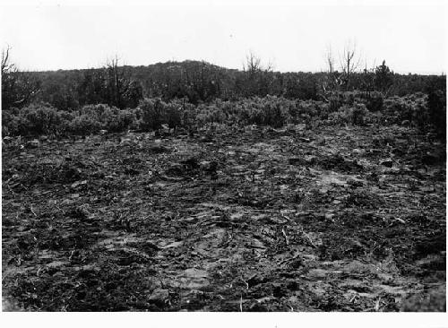
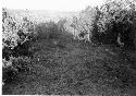
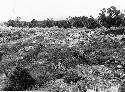
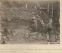
33-7-10/1380.1.399
Display Title
House area, after clearing
Descriptions
Department
Photographic
Date
1932
Geography/Provenience/Site Name
North America
/
United States
/
Utah
/
<County>
/
<City>
/
Site 2
Intrasite
House Area
Additional Geographic Terms
Alkali Ridge
Materials
Print, black and white
Dimensions
Overall: 8.5 x 12 cm (3 3/8 x 4 3/4 in.)
Important Note about Historical Language
Collections records may contain language, reflecting past collecting practices and methods of analysis, that is no longer acceptable. The Peabody Museum is committed to addressing the problem of offensive and discriminatory language present in its database. Our museum staff are continually updating these records, adding to and improving content. We welcome your feedback and any questions or concerns you may want to share. Please email us with your comments.
| PrimaryMedia | Object Number | Title | Classification | Geography/Provenience | SHARE |
|---|---|---|---|---|---|
| 2004.24.10701 | House area after clearing |
San Juan County
| ||
| 2004.29.1976 | Looking south after clearing. |
Madisonville
| ||
| 2000.25.1.182 | Main plaza after clearing |
Mexico
| ||
| 33-7-10/1380.1.52 | Refuse mound from N.W. after clearing |
Site 12
| ||
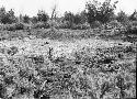
| 33-7-10/1380.1.445 | After clearing; kiva depression in foreground |
Site 3
| ||
| 33-7-10/1380.1.436 | Refuse mound after clearing; trench lined out for excavation |
Site 2
| ||
| 33-7-10/1380.1.459 | Refuse mound after clearing; trench lined out |
Site 3
| ||
| 33-7-10/1380.1.351 | Group 1 from Southeast, After Clearing |
Ab7-1
| ||
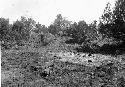
| 33-7-10/1380.1.398 | After clearing off sagebrush |
Site 2
| ||
| 33-7-10/1380.1.8 | After clearing. |
Site 12
| ||
| 2004.24.10754 | Site After Clearing, Kiva Depression In Foreground |
San Juan County
| ||
| 2004.1.381.1.308 | West side of Mound 26 after clearing |
Copan
|