Skip to main content
Object Number
2010.1.30.199
Display Title
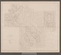
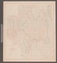
Annotated Work Plan Flow Chart from the Salt-Gila Aqueduct Archaeology
Descriptions
Department
Archival, Oversize Paper
Date
August 28, 1980
Artist
Nancy Lambert Brown
Geography/Provenience/Site Name
North America
/
United States
/
Arizona
Quantity
1
Important Note about Historical Language
Collections records may contain language, reflecting past collecting practices and methods of analysis, that is no longer acceptable. The Peabody Museum is committed to addressing the problem of offensive and discriminatory language present in its database. Our museum staff are continually updating these records, adding to and improving content. We welcome your feedback and any questions or concerns you may want to share. Please email us with your comments.