Skip to main content
Object Number
77-57-10/100523.1.1
Display Title
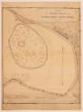
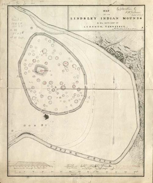
Map of the Lindsley Indian Mounds, 4 miles South East of Lebanon, Tennessee
Descriptions
Object Description
Map of the Lindsley Indian Mounds, 4 miles South East of Lebanon, Tennessee. Expedition by F.W. Putnam, Sept 1877
Department
Archival, Paper
Date
1877
Artist
A.H. Buchanan
Geography/Provenience/Site Name
North America
/
United States
/
Ohio
/
Warren County
/
Lebanon
Intrasite
Lindsley Indian Mound
Additional Geographic Terms
4 miles South East of Lebanon
Materials
Papaya Ink
Dimensions
Overall: 25.6541 x 30.7341 cm (10 1/8 x 12 1/8 in.)
Quantity
1
Important Note about Historical Language
Collections records may contain language, reflecting past collecting practices and methods of analysis, that is no longer acceptable. The Peabody Museum is committed to addressing the problem of offensive and discriminatory language present in its database. Our museum staff are continually updating these records, adding to and improving content. We welcome your feedback and any questions or concerns you may want to share. Please email us with your comments.