Skip to main content
Object Number
2004.24.11376
Display Title
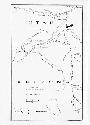
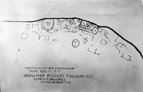
Map of Kin Na Ilth Ruins
Descriptions
Object Description
Map of Kin Na Ilth Ruins
Keywords
- Archaeological
- Site and Excavation
Subject
- Site
Department
Photographic
Date
1933
Artist
Dr. Douglas S. Byers
Culture
- Southwest
Geography/Provenience/Site Name
North America
/
United States
/
Utah
/
<County>
/
<City>
/
Floating House Ruin
Materials
Negative, cellulose acetate
Dimensions
Overall: 10.16 x 15.24 cm (4 x 6 in.)
Important Note about Historical Language
Collections records may contain language, reflecting past collecting practices and methods of analysis, that is no longer acceptable. The Peabody Museum is committed to addressing the problem of offensive and discriminatory language present in its database. Our museum staff are continually updating these records, adding to and improving content. We welcome your feedback and any questions or concerns you may want to share. Please email us with your comments.