Skip to main content
Object Number
65-41-40/364.1
Display Title
Western Ireland County map
Descriptions
Object Description
Clare sheet 24. Edition of 1919. Surveyed in 1840. Revised in 1913-14. Re-levelled in 1915. Published by the Director General at the Ordnance Survey Office, Phoenix Park, Dublin, 1919. The Altitudes are given in Feet above the Low Water of Spring Tides in Dublin Bay, which is 21 Feet below a mark on the base of Poolbeg Lighthouse. Altitudes indicated thus (B.M. 54-7) refer to Bench Marks on Buildings, Walls, &c., those marked thus (-52) to surface levels. Crown Copyright Reserved. Scale_six inches to One Statute Mile or 880 Feet to One Inch = 1/10560.
Inventory Description
Map
Department
Archival, Oversize Paper
Date
1919
Artist
Ordnance Survey Office, Dublin
Geography/Provenience/Site Name
Europe
/
Ireland
Additional Geographic Terms
Knagraigue West to Applevale; Ntysmarry to Ahasl
Materials
Print Paper
Dimensions
Overall: 73.66 x 104.14 cm (29 x 41 in.)
Quantity
1
Important Note about Historical Language
Collections records may contain language, reflecting past collecting practices and methods of analysis, that is no longer acceptable. The Peabody Museum is committed to addressing the problem of offensive and discriminatory language present in its database. Our museum staff are continually updating these records, adding to and improving content. We welcome your feedback and any questions or concerns you may want to share. Please email us with your comments.
| PrimaryMedia | Object Number | Title | Classification | Geography/Provenience | SHARE |
|---|---|---|---|---|---|
|
Image Not Available
for Western Ireland County map
| 65-41-40/364.3 | Western Ireland County map |
Ireland
| ||
|
Image Not Available
for Western Ireland County map
| 65-41-40/364.2 | Western Ireland County map |
Ireland
| ||
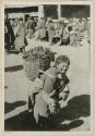
| 35-10-60/16290.1.23 | Boy carrying backet of argols |
Tibet
Gansu | ||
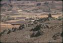
| 2019.4.1.167 | Farms and fields |
Bolivia
| ||
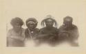
| 2004.29.22577 | First photograph taken of the mountain tribes of southeastern New Guinea |
New Guinea
| ||
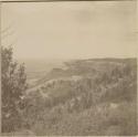
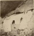
| 2004.29.544 | Cliff Palace, road leading to it, view of Col. "Sphinx" front ruins |
Cliff House
| ||
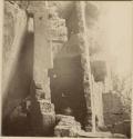
| 2004.29.543 | Steps between the Cliff Palace ruins |
Cliff House
| ||
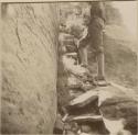
| 2004.29.542 | Frederic Ward Putnam and another man climb wall of Cliff Palace |
Cliff House
| ||
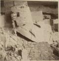
| 2004.29.540 | Cliff Palace ruins, with cracked walls beneath |
Cliff House
| ||
| 2004.29.538 | Cliff Palace ruins, the painted room murals |
Cliff House
| ||
| 2004.29.537 | Debris behind walls of Cliff Palace ruins |
Cliff House
| ||
| 2004.29.539 | Cliff Palace ruins from south |
Cliff House
|