Skip to main content


Object Number
2004.29.691.7
Display Title
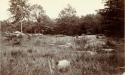
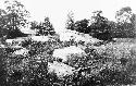
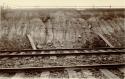
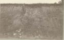
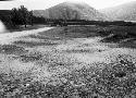
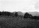
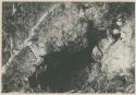
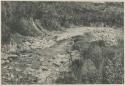
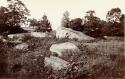
Crystalline outcrop near Lenape Council Field. Head waters of Naaman’s Creek
Descriptions
Object Description
Written on board: "Delaware. / Photo made by I. McGee Esq., U.S. Geological Survey. / Crystalline outcrop near Lenape Council Field. Head waters of Naaman’s Creek / Claymont, Delaware."
Keywords
- Site and Excavation
- Archaeological
Subject
- Site
Department
Photographic
Date
1889-1890
Artist
I. McGee, Esq.
Culture
- Northeast
Geography/Provenience/Site Name
North America
/
United States
/
Delaware
/
New Castle County
/
Claymont
Additional Geographic Terms
Lenape Council Field, Naaman's Creek
Materials
Albumen print adhered to Paperboard
Dimensions
Overall: 12.7 x 20.32 cm (5 x 8 in.)
Important Note about Historical Language
Collections records may contain language, reflecting past collecting practices and methods of analysis, that is no longer acceptable. The Peabody Museum is committed to addressing the problem of offensive and discriminatory language present in its database. Our museum staff are continually updating these records, adding to and improving content. We welcome your feedback and any questions or concerns you may want to share. Please email us with your comments.